It was a very smokey day, so vistas were hazy.
This is a photo of the old gorge into which the dam was placed.
Right now there is upgrading work on the spillway. It was really breath-taking to hear about all the monitoring of the dam structure, the water chemistry & water levels, the management of 4 fish species which is highly complex involving transporting fish at various stages.
More amazing was that all this monitoring is going on many times a day. This is where my taxes go & it's going on while I am not informed enough to know I need it!
I did feel the gratitude of being so well cared for.
This was a pool below the dam. I was surprised by how white the rocks were. They are bedrock, scoured by glaciers of the ice age.
We piled into a school bus to journey up the east side of the lake.
Later we will go off at right angles to the east.
We were in deep forest with lots of moss in trees, dark understory. In many ways it reminded me of parts of the Vancouver Island rainforests. Looking up I could a few times glimpse mountains. We crossed power lines several times. I couldn't figure out how many 'lines' crossed the mountain.
This is the north end of the Capilano reservoir looking south.
Nearby evidence of sluices & gates.......& other human activities requiring equipment.
This area is where the silt was removed from the water in the early days.
Now the Capilano watershed water is pumped through Grouse Mountains by tunnel to the Seymore facility that takes any turbidity called "rock flour" out of the water. This flour is the silt left over from from the glacial scouring of all the river valleys in the Lower Mainland. It shows up in the water after heavy rains & landslides.
The water is also treated by ultra violet light to remove bacteria. The water then comes back to Capilano by gravity. Hydro power is gathered on the return to supply the energy needed for the uphill trip. It's a convenient loop.
A few years ago there was a big landslide in the Capilano system & we all had pretty cloudy water for a few weeks until the silt settled out. That will not happen any more since now the Seymore facility treats the water before it gets to us.
This is a huge old pipe for water transport.
This is the staircase up to the caretaker's home at the north end of the reservoir. They had great lawns & a laurel hedge, now faint memories.
On the far side of the photo is the edge of the concrete foundation of the caretakers' house.
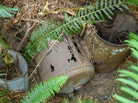
Look down, look around, & bingo! More archeology!
We then went up the east arm of the Capilano River to a lake, Rogers Lake, which is a back-up water source. It is sometimes drained into the Cap Reservoir when reservoir gets too hot. This is to reduce bacterial growth in the water. [Who knew?] There are two other lakes up there.
I just loved the filtration system at the end of this lake before it drained into the east arm of the upper Capilano River.
I saw old wood everywhere!
We saw many bankings that looked like this: lateral moraine & rocks rounded by glacial tumbling.
This tour is free. I will do it again for sure because I found it so fascinating. There are family tours into the Seymore facility too.
The last photo goes to Chief Joe Capilano who went to England to negotiate with the King. Capilano means beautiful river. The chief did not get what he wanted, maybe, I think.
That's all for now.


Love this, Daph! I regularly go up the mountain and take the gondola down, and see the watershed. This gives me more understanding. thank you!
ReplyDelete